
Travel apps for low vision are popping up all over
Traveling safely and independently can be challenging if you have low vision. But lately, there have been numerous advancements in navigational mobile apps especially designed for people with vision loss. In general, these types of apps require certain infrastructure or mapping to be implemented for a specific location, creating a replicable model for expansion. Here are a few travel apps for low vision to check out at various locations in the US and abroad.
All Aboard
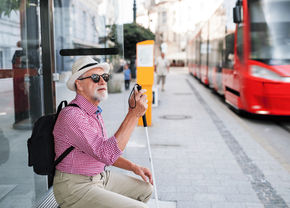
Although GPS apps can help people get about 10 meters from their target, this is often not close enough to catch a bus, especially for those who cannot rely on their sight to find a bus stop sign. To address this issue, researchers at Schepens Eye Research Institute of Massachusetts Eye and Ear developed an app that uses artificial intelligence to identify bus stop signs through the phone’s camera. Sonar sounds increase in pitch as the user gets closer to the bus stop. The All Aboard app is available as a free download for iOS devices and currently works in a number of major transit hubs in the US, Canada, Germany, and the UK.
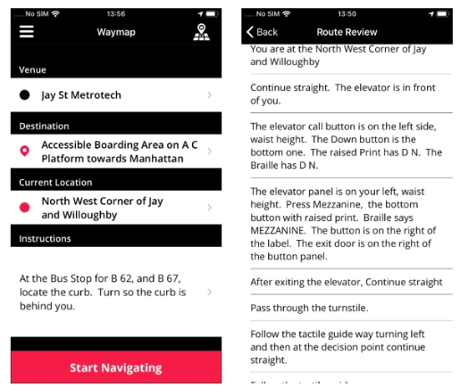
Waymap
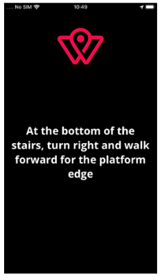
The Waymap app for Apple and Android brings audio navigation to three Metro stations in Washington D.C. Once users download the maps to their phone, they can navigate the station without the use of GPS, WiFi, or even a cell phone signal. Precise instructions guide users on the number of steps and how many degrees to turn to get to the desired destination. Plans are in the works to roll out the technology to the entire Metro system, and several stations in NYC are also piloting the program.
GoodMaps
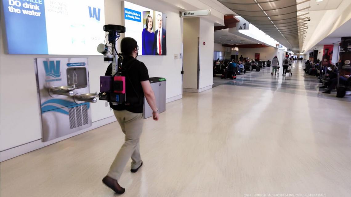
Person using GoodMaps’ LiDAR mapping technology to develop a digital map of the Louisville International Airport. Credit: Louisville Muhammad Ali International Airport via Biz Journals.
In Kentucky, the Louisville Muhammad Ali International Airport is working with GoodMaps to help visually-impaired travelers move independently through the terminal. By using LiDAR (Light Detection and Ranging) technology, GoodMaps provides precise instructions to help users locate airport amenities such as restrooms, charging stations, restaurants, and more. The app is ready-to-download for both iOS and Android devices.
AccessNow
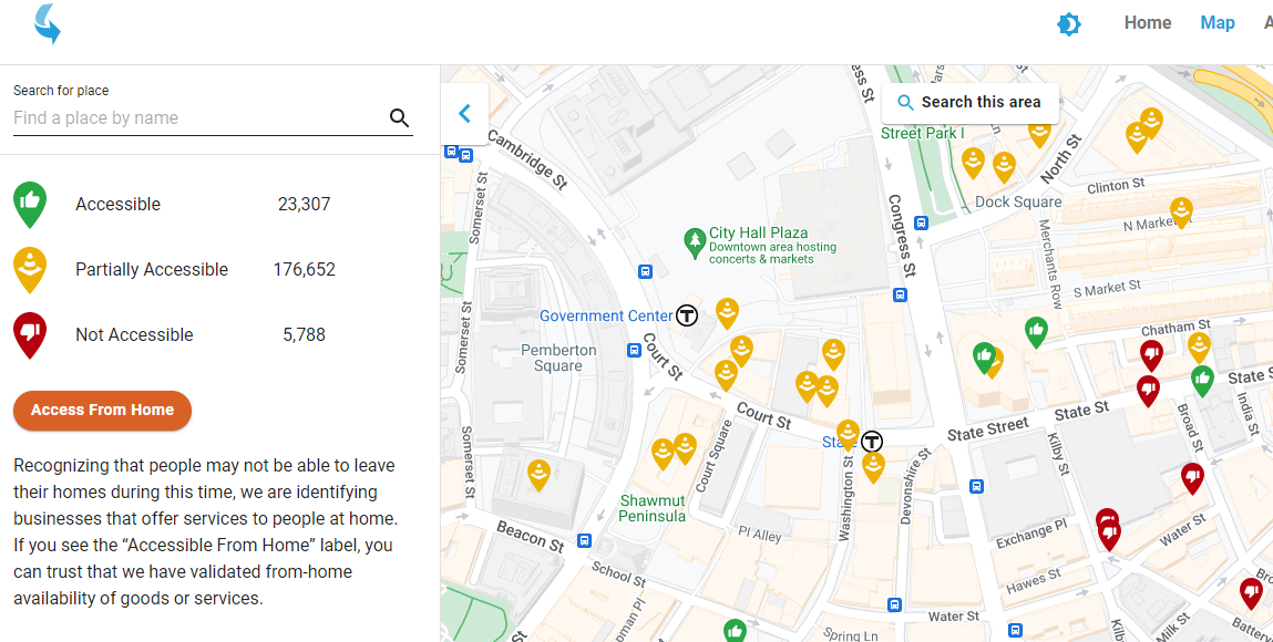
Here’s a tool you can use to find accessible places in your neighborhood or while traveling. AccessNow is a crowd-sourced app for iOS and Android that allows you to search and discover accessible places and contribute to the database by adding your own reviews. Users can filter results by desired accessibility features, such as Large Print or Braille signage.
BONUS Tip
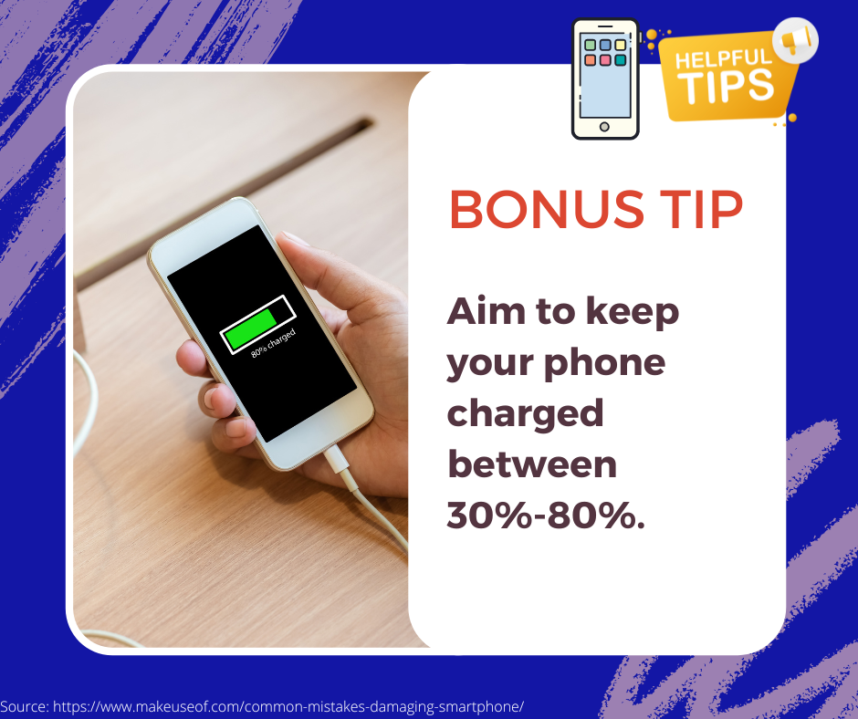
Of course, using your phone for apps like these can drain the battery. You may be tempted to charge it up fully to avoid a dead battery while traveling. However, it’s actually best to aim to keep your phone charged around 30%-80%. A phone’s battery has a limited number of charge cycles, and repeatedly allowing the battery to run down all the way or fully charge to 100% will reduce its performance over time. You can opt to carry a portable charger with you in the event that you need a charge on-the-go.
Final thoughts on travel apps for low vision
It’s interesting to see how varied technologies are being used to achieve the same goal — namely, helping blind and low vision travelers get from point A to point B safely and independently. While some apps are location-specific, hopefully the trend will catch on quickly at other locations across the country and around the globe. If you’ve tried any of these apps and would like to give feedback, or if you know of another app in this category you’d like to recommend, please leave a comment below. By spreading the word about these types of digital resources, we can help each other gain confidence and achieve success in traveling independently.
Author Information
By Bethany Wyshak. Reviewed by Stuart Flom.
Sources
Access Now. (n.d.). AccessNow. Retrieved June 15, 2022, from https://map.accessnow.com/
Cawthon, H. (2022, May 20). How GoodMaps is helping the Louisville airport improve accessibility. KYINNO. Retrieved June 15, 2022, from https://www.bizjournals.com/louisville/inno/stories/news/2022/05/20/goodmaps-sdf-explore.html
GoodMaps. (n.d.). GoodMaps Explore | Goodmaps. Retrieved June 15, 2022, from https://www.goodmaps.com/apps/explore
Loic, L. (2022, May 10). 7 Common Mistakes That Are Damaging Your Smartphone. MUO. Retrieved June 15, 2022, from https://www.makeuseof.com/common-mistakes-damaging-smartphone/
Mlot, S. (2022, May 25). Waymap Starts Guiding Blind People Through Washington Subway Stations. PCMAG. Retrieved June 15, 2022, from https://www.pcmag.com/news/waymap-starts-guiding-blind-people-through-washington-subway-stations
MTA. (n.d.). Waymap. Retrieved June 15, 2022, from https://new.mta.info/accessibility/stationlab/waymap
Venkat, V. (2022, May 2). All Aboard Is Making Bus Stops More Accessible For Blind Bus Riders. Assistive Technology Blog. Retrieved June 15, 2022, from https://assistivetechnologyblog.com/2022/05/all-aboard-bus-stops-accessibility.html